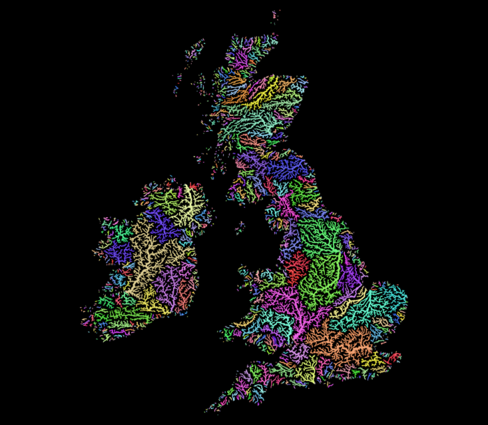
Thats beautiful… how long it took?
Well, that looks like QGIS’ random colors applied to http://hydrosheds.org/
So I fired up QGIS, extracted the region from eu_riv_15s.zip, realised those rivers came without a corresponding basin, extracted the region from eu_bas_15s_beta.zip, set the map background to black, set the rivers to render in white, set the rivers’ line width to correspond to their UP_CELLS attribute (best with an exponential scale via Size Assistant), put the basins on top, colored them randomly by BASIN_ID, set the layer rendering mode to Darken or Multiply and that was it.

I should open an Etsy store.
Yes, I realise that replicating things is easier than creating them. But seriously, this is just a map of features colored by category and all the credit should go to http://hydrosheds.org/
Update
But Hannes, that original has some gradients!
Ok, then set the rivers not to white but a grey and the basin layer rendering mode to Overlay instead of Darken.

This product incorporates data from the HydroSHEDS database which is © World Wildlife Fund, Inc. (2006-2013) and has been used herein under license. WWF has not evaluated the data as altered and incorporated within, and therefore gives no warranty regarding its accuracy, completeness, currency or suitability for any particular purpose. Portions of the HydroSHEDS database incorporate data which are the intellectual property rights of © USGS (2006-2008), NASA (2000-2005), ESRI (1992-1998), CIAT (2004-2006), UNEP-WCMC (1993), WWF (2004), Commonwealth of Australia (2007), and Her Royal Majesty and the British Crown and are used under license. The HydroSHEDS database and more information are available at http://www.hydrosheds.org.
Update: Someone asked me for more details so I made a video. Because I did not filter the data to a smaller region I did not use a categorical style in this example (300,000 categories QGIS no likey) but simply a random assignment.
thanks you for explanation, honestly it’s cool
Pingback: Was ist HydroSHEDS? | #geoObserver
Can you make a world map or QGIS dataset of watersheds above 100,000km^2 area?
When I load all the hydro watersheds it crashes Google Earth
Don’t need all the tributaries just the area, though main river would be coo
l
You should be able to get an approximation of the areas by using alpha shapes in QGIS. I am not sure though, maybe the areas are also provided by the Hydrosheds project.