Category Archives: qgis

UTM coordinate grids of Hamburg

The coordinates are wrong, I should have be xmin and ymin to match the official grid. Will update the PDFs soonish, sorry!

The LGV offers their official UTM grid for Hamburg in the Transparenzportal. Since many datasets are indexed by those grid tiles, it can be handy to have a quick references. Queue QGIS!

Load the layers “utm_raster1km any” and “utm_raster2km any” of the GML file. The CRS is EPSG:25832. Set their styles to have no fill.

Label with substr(x_min($geometry),0,4) || '\n' || substr(y_min($geometry),0,5) to truncate the coordinate display to just the interesting bits, the three leading numbers of X and the four leading numbers of Y.

Print them. You now have nice maps of the grid that you can use as reference when browsing through files with names like dgm1_32552_5936_2_fhh.xyz, LoD1_571_5939_1_HH.xml or dop20c_32576_5953.jpg (ignore the leading 32…).

I added the Stadtteile as background (and Wished QGIS could style by the 4 color theorem).

Click to download PDFs (they should be DIN A4, ask the composer why they are not):
1km2km

Fancy shaded and scaled contour lines in QGIS

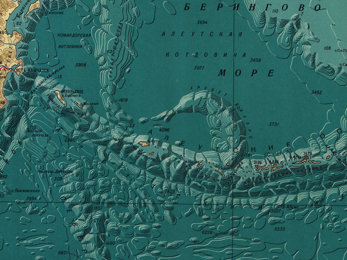
Daniel P. Huffman shared this gorgeous map earlier. ArcMap just got the functionality to create such contour lines.
CFnWnA5UkAAuFm9

Naturally I had to try to re-create that style in QGIS. I semi-succeeded:

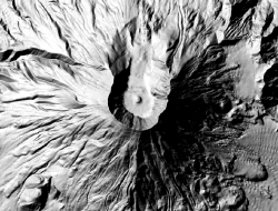
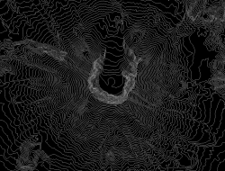
You have a DEM, eg mtsthelens_after.zip. Generate a hillshade from DEM. Generate contour lines from DEM.
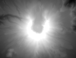
dem hillshade contours

Split the lines by segment, for example with the “Network” plugin. Select all features on your layer and then use its “Split” function.
Calculate the azimuth of each line. See this magical formula (I wish QGIS would have a function ready).
Rotate the angle according to your hillshade light angle. For example:
CASE
 WHEN ("azimuth"+270) > 360
  THEN ("azimuth"+270-360)/500
 ELSE ("azimuth"+270)/500
END

And use that to scale your lines’ widths (the 500 is a constant factor here to get them small enough).

Disable all layers but hillshade and contour lines.
Move hillshade above contour lines.
Set map background to black (equals 0 in the blending multiplication later).
Use black to white as color ramp for the hillshade.
Set hillshade’s blending mode to multiply.
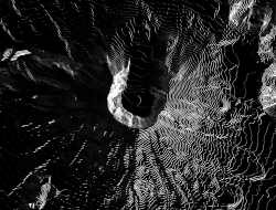
You now have the bright parts of the contour lines. Unfortunately QGIS does not yet support blending modes for whole groups so you will have to combine this with the next step in a raster graphics tool of your choice. Gimp works fine.
Take a screenshot of something.

Invert hillshade color ramp to white to black.
Rotate your angle by 180 (so it would be 90 instead of 270 in the example above).
You now have the dark lines.
Take another screenshot.
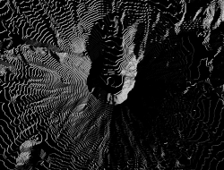
conscalehilmul270 conscalehilmul90
Add both images to a image in Gimp, Color to Alpha with black, invert the dark one, choose nice background, done!
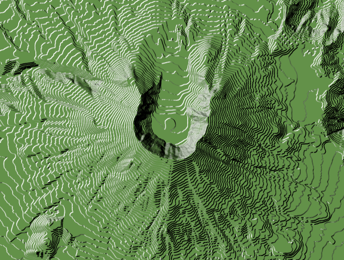
scaled line width

This is still pretty rough as it’s mostly hack after hack and not “done properly”™. The blending adds some shadows where there should not be. In a way the lines end up being same width because of this. The scaling was done arbitrarily, there is probably some smart way with a better scale. Some fancy smoothing of the lines would look great. Coloring the areas between the lines would probably improve it as well. Once QGIS gets support for blending modes of groups, this will be much easier.
Merge GML files into one SQLite or Spatialite file

For example the buildings in Hamburg, Germany:

layer=$1
for file in *.xml
do
 if [ -f "${layer}".spatialite ]
 then
  ogr2ogr -f "SQLite" -update -append "${layer}".spatialite "${file}" "${layer}" -dsco SPATIALITE=YES
 else
  ogr2ogr -a_srs EPSG:25832 -f "SQLite" "${layer}".spatialite "${file}" "${layer}" -dsco SPATIALITE=YES
 fi
done

Remove the -dsco SPATIALITE=YES and change the output filename for SQLite. QGIS can work with both.

$ bash mergexmltospatialite.sh AX_Gebaeude

Be aware that Spatialite is much more sensitive to geometric problems. You might get things like

ERROR 1: sqlite3_step() failed:
ax_gebaeude.GEOMETRY violates Geometry constraint [geom-type or SRID not allowed] (19)
ERROR 1: ROLLBACK transaction failed: cannot rollback - no transaction is active
ERROR 1: Unable to write feature 1712 from layer AX_Gebaeude.

ERROR 1: Terminating translation prematurely after failed translation of layer AX_Gebaeude (use -skipfailures to skip errors)

but on the other hand, you get spatial indexing which makes queries or high zoom interaction much quicker.

Be aware that if you try to merge files into a Shapefile and fields are getting truncated, those fields will only be filled with data for the first file you merge. On the later files OGR will try to match the input field names to the merged file’s fieldnames, notice the difference and discard them. If you still want to convert to Shapefiles, check out the -fieldTypeToString IntegerList,StringList options.